The Clearwater
July 1993
This trip was to be my introduction to whitewater. Four years earlier I (Peter) had previously made one, flat-water canoe trip, the Bagwa loop and Kingsmere Lake, over an easy four days, in Prince Albert National Park.
When Warren sent me the guide to Canoe Trip No. 58 from the Saskatchewan Parks Branch, and I read all the cautionary notes, I wondered about it a little, but considered that I was to be with an experienced group in three canoes, and I believed Warren knew what he was doing. I have pasted in bits of the Canoe Saskatchewan route description (in italics) where I think they are relevant to my novice view of this trip. This was also my first experience of wilderness camping .
The members of the group were:
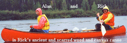
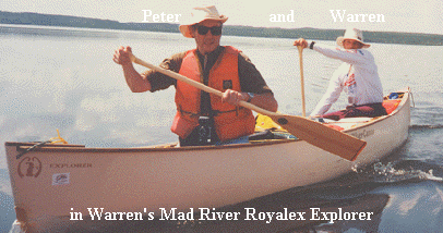
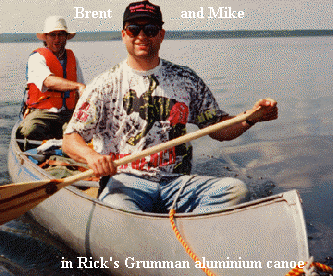
You can click on the names - Rick, Alan, Brent, Mike, Peter, and Warren - to see brief bios on Warren's web sites.
Brief Background for non-Canadians
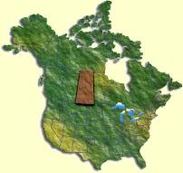
![]() This
trip was in North-western Saskatchewan. If you look on the
map of Canada, Saskatchewan is almost in the middle of the country. The
trip area is located at the southern edge of the northernmost third of the
province, but all of the cities and towns are in the southern half of the
province, so the northern half is definitely wilderness
This
trip was in North-western Saskatchewan. If you look on the
map of Canada, Saskatchewan is almost in the middle of the country. The
trip area is located at the southern edge of the northernmost third of the
province, but all of the cities and towns are in the southern half of the
province, so the northern half is definitely wilderness
The Clearwater
Most of Saskatchewan drains towards the northeast, eventually into Hudson’s Bay. However, the extreme northwest part of the province drains to the west and northwest, eventually reaching the Athabasca, the Mackenzie and the Arctic Ocean. The Clearwater is a short distance north of the watershed between the two systems and, in fact, was part of the original fur-trading access route to the Athabasca system, over the 20km (12.5 mile) Methye Portage between the two systems.
The Clearwater was a pivotal link during the height of the fur trade period. Peter Pond was the first European to cross the Methye Portage in 1778, after which this height of land, and the Clearwater River, became a prime exploration and trade route between the Hudson Bay and Arctic watersheds for over 100 years.
The Clearwater is a Canadian Heritage River
Canoe Saskatchewan - Route 58Clearwater River from Lloyd Lake to Warner Rapids
Length of Trip: 147 Kilometres (91 Miles); Time Required to Complete Trip: 6 to 8 days
Number of Portages: 3 to 9 (Depending on choice, and experience of canoeists)
This is a challenging trip and it is not recommended for those with minimal canoeing skills, or with no whitewater experience. Many of the rapids encountered are shallow and rocky and may present varying degrees of difficulty depending on water levels. Portages were found only past major navigational hazards such as waterfalls and larger rapids.
Canoe parties should be well equipped and prepared for self-contained wilderness travel and minimum impact activities. Adequate first aid, equipment repair and navigational equipment are required. Except for food consumed en route, everything packed in must be packed out. Digging of garbage pits and cutting of tent poles are prohibited.
The Saskatchewan section of the Clearwater flows southeast for about half its length and then turns southwest, enabling the start and finish of the trip to be made from points about 60 km apart on the same road, the Semchuck Trail, Highway 955. The area is wilderness, consisting of precambrian shield granite rocks, with many lakes filling the depressions and coniferous forests on the hills. There are also numerous glacial features such as eskers (sand and gravel deposits from rivers that ran under or in glaciers) and moraines (loose rock deposits which had fallen onto and been transported by the glacier ice and which were left behind when the ice melted).