Day 4; Tuesday 27th July
Some of the party woke up late (i. e. 9 am). We had jack fish and scrambled eggs for breakfast, then packed up camp, but did not load. We paddled the 2.5 km up to the head of the Virgin River, which ends in some falls coming down from Careen Lake. There is a fly-in fishing camp on Careen Lake and the trail to it climbing alongside the falls was in good shape. We hiked up the trail, but Brent, Warren and Rick stopped part way up to fish for Arctic Grayling in the pools, while Mike, Alan and I continued up the trail to the camp.
The fishing party met two people from the fishing camp also fishing for grayling. The people from the camp were surprised so see anyone there; they had spent several thousand dollars to fly in to their wilderness experience! Rick caught a rare arctic grayling on a small spoon (the grayling looked sort of insignificant to me but Rick was proud of it).
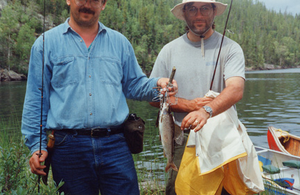
We paddled back to the campsite and cooked the grayling (in butter of course). The grayling didn’t taste all that great; however, (as Rick said) these fish are noted for their fighting and not their eating. Then we loaded the canoes and continued on our way.
Just below the junction of the Clearwater and Virgin Rivers there is a short Class 2 rapid (P5) which should be examined prior to running. If canoeists elect to run this rapid, the best route is the central chute at the top followed by a sharp left to avoid the central boulders at the foot of the rapid. A good portage trail by-passes this rapid on the left.
![]()
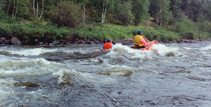
We paddled to and ran P5/R2.
About 3 kilometres below this rapid the canoeist encounters a short Class 2 rapid which should be examined prior to running.
We ran this easy R2.
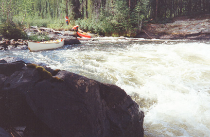
One kilometre below this rapid there is a 1.5 metre (5 foot) fall (P6) which must be portaged.
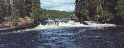
This fall is divided into three chutes by two islands. The portage trail is on the right, or northwest, side of the right hand channel.
We took a good look at this one. Two canoes (Warren and I, Rick and Alan) chose to line down the falls portion of P6.
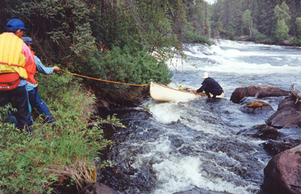
We moored the canoes in a pool below the rocky stretch. Warren was sure we could run the rest (through all that foamy white stuff in the foreground)
But, Brent and Mike elected to portage across an island beside falls and come out at the base of the falls. This proved to be a mistake because they were unable to scout the rest of the rapids.
We reconnoitered the remainder of the R3 from another island.
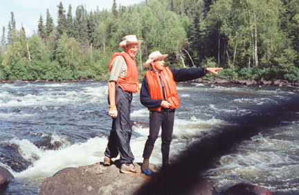
We tried to bellow and hand-signal recommendations to Mike and Brent stuck on the wrong island, but our instructions were only partially understood.
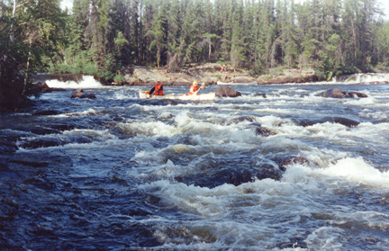
Warren and I ran first, with a clear and dry run.
This was the rapid where Brent learned that you should follow the current, not just go straight down the rapid. In this case, the main flow made a large zigzag. Brent and Mike did not. Once the canoe was full of water, it became harder to control and HEAVY. They piled into a rock, at the speed of the current. With 800 pounds of water in it, the canoe didn’t enjoy being halted. In fact, it buckled in several places. We learned more about the damage at the next campsite. Warren and I retrieved Brent’s throw rope, but the clip snapped as we pulled. Mike and Brent then paddled the swamped canoe to shore. Unfortunately, in the excitement, we did not get any pictures.
Rick and Alan then ran the rapid OK.
500 metres below the end of Portage Number 6, the canoeist encounters a long and difficult Class 3 rapid (P7). It is advisable to examine the entire length of this rapid prior to deciding whether to run or portage it. We paddled to P7, ran it. We did not notice it as being a long and difficult R3. Then 9 km, with some fast water, brought us to a granite gorge.
The gorge contains Class 3 to 4 rapids (P8) which should be portaged.
Portage Number 8: 300 metres long and in good condition, though running through the area of a 1983 forest fire. This portage starts at a rocky landing on the right, or north, side of the river 15 metres prior to the start of the gorge, and 75 metres prior to the rapids. The trail ends at a marshy area a few hundred metres north of the end of the gorge
We arrived at P8 at about 5 pm. The landing for the trail was marked with a fine set of moose antlers and skull. We portaged along a long trail to a high sand bank with trees overlooking a back bay, complete with mosquitoes, although these were worse lower down. We camped there and set up an excellent tarp. There was lots of rain as we were setting up camp (the rain started before we got our tarp fetish up).
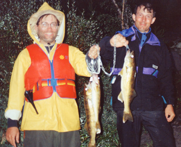
Rick, Warren and Brent went fishing for walleye at the base of the rapids and caught three good ones for dinner.
We also cooked spaghetti and sauce. After dinner we stamped out the dents in Brent’s canoe. From a paddling point of view, the canoe was badly “hogged”. That is, the middle of the canoe drew less water than the ends, resulting in a canoe that steers poorly on flat water, and even worse in rapids. From a structural point of view, the whole bottom of the canoe bulged up, but we managed to stamp it back into some sort of shape. Brent was quite depressed about the damage to his canoe and mumbled something about this being the canoe’s last trip. (Six years later and many more rocks, he is still mumbling about getting a new canoe.) Warren went for a bathe surrounded by a cloud of mosquitoes, but no-one else ventured into the water.
There were lots of moose calls during the night.
On Day 4 we had paddled about 30 km in addition to exploring Virgin Falls.