Day1; Saturday 24 July
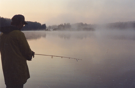
I woke at 5.30 am, to mist on the water. Rick, another early riser, went fishing but again no bites.
Access to Starting Point:
The actual trip starts from the end of a 3.25 kilometre fair weather, soft sand road which leaves Highway 955 heading east at a point 122 kilometres north of La Loche. Depending on condition of the fair weather road, a 1.5 - 2 km carry to the lake may be necessary. There are a number of cabins situated at the end of this road on the western shore of Lloyd Lake. It is not recommended that vehicles be left at this location during the trip.
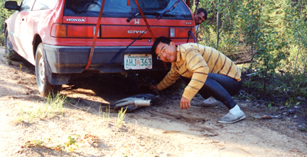
The Civic did not like the “fair weather road” which was really sand with many large rocks sticking out. First we removed the muffler, and left it by a tree to be picked up later.
Then we became stuck in sand. Getting the Civic out of the sand was more difficult than it sounds. Because the muffler had fallen/been ripped off, the exhaust pipe dragged on the ground. This was okay, but as soon as we got stuck in the sand, the problem became more acute since we could not reverse since the pipe dug into the ground like a barb. So, the only way out of the sand was forwards, no “rocking” was possible. We jacked up the car, pushed logs in underneath together with a piece of handy plywood, and finally pushed out.
The K Car made it over the fair weather road OK, but its exhaust pipes also had the hell beat out of them.
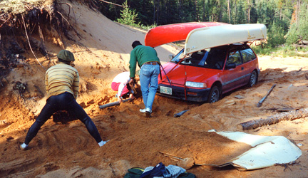
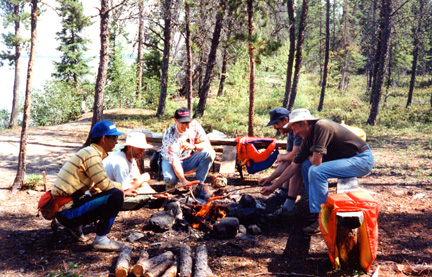
At the lake shore, near the empty cabins (we had been told that the cabins were the local Chief’s fishing cabins), there were again LOTS of flies, so wearing bug hats, we unloaded the canoes and equipment. Brent and Alan left to shuttle the Civic to leave it at Warner Bridge, and hide the K car in the bush near the junction of the access road with Highway 955. The rest of us made coffee, ate bagels and cream cheese, loaded the canoes, and waited for the shuttle to be completed.
Just before Rick put his canoe into the water, he proudly announced that he had finally found and patched the last hole. (Rick’s canoe, along with his wet feet had been a standing joke among us). In fact, he was willing to make a bet with Warren. Warren, not being the gambling type, declined. As soon as Rick put the canoe in the water and sat down, a small fountain of water shot up a few inches. While the rest of us rolled with laughter, Rick turned to Warren and said: “You should have made that bet”.
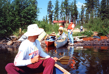
We finally finished loading the canoes and started paddling at 11 am.
![]() The canoe route leads east and southeast across Lloyd Lake for a distance of 20 kilometres to Gibson
Bay
at the outlet of the lake.
The canoe route leads east and southeast across Lloyd Lake for a distance of 20 kilometres to Gibson
Bay
at the outlet of the lake.
At 1 pm we went ashore for lunch. We cooked hot dogs and sat on some nice benches someone had made.
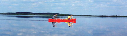
The lake was like glass, and it was warm, with no or almost no wind. Normally we would not paddle out into the middle of such a large lake, but made an exception here because the lake was so calm.
Later it became quite warm and sunny so Rick and Mike borrowed Warren’s sunblock that turned out to be Sandy’s moisturizer (or something) and certainly did not block the sun!
On the paddle across the lake, Brent and Mike were consistently behind everyone else. Of course, they blamed this on having an extra backpack in their canoe. Rick was sure that he had patched all the leaks in his old wood and canvas canoe but of course there were still many and he had to bail even on the calm lake.
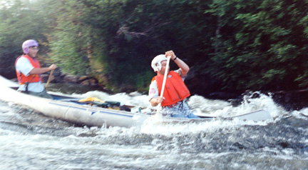
The first rapid (P1), and optional portage, occur 6.5 kilometres from the entrance to Gibson Bay. This rapid consists of two Class 2 chutes and one Class 3 chute which, depending on water levels and experience of the canoeists, can either be portaged, run or lined. NOTE: Care should be exercised when descending this rapid as a water survey station with a cable across the river is situated between the two top sections of the rapid.
At this time, Warren decided that I needed some elementary instruction, and so pointed out downstream Vees which are the way to go (most appeared to me to end in another big rock farther down), and told me how to ‘draw’, ‘cross draw’ (much easier than prying), ‘eddy-in’ and ‘eddy-out’. We ran the first R2 (Class 2 rapid), ducked under the survey cable, and ran the second R2. Rick and Alan had intense discussions about how to run rapids. Rick was very impressed with Alan’s technical skill. They attempted a fancy route through this rapid suggested by Alan. They tipped and swam to shore!.
Novice Lesson No. 1 I caught onto drawing, and eddying in and out quickly since they are just basic fluid mechanics. However, I could not distinguish which lumps of water concealed rocks (to be avoided) and which were just water (and could be splashed through). I found it best not to take any initiative and to wait for Warren to quietly yell something.
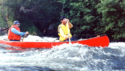
Two kilometres below Portage Number 1 a short Class 3 rapid (P2) occurs at a sharp bend in the river which, depending on water levels and experience of the canoeists, can either be portaged, run or lined.
To reconnoiter this rapid we tied up to a small tree, which was already occupied by a wasp nest and as we shook the tree the wasps streamed out. Mike and I briefly contemplated jumping into the rapid to escape, as I am allergic to these creatures. Fortunately, the wasps never identified the cause of the disturbance.
Rick and Warren ran the R3. (Note by Warren and Rick). This rapid was much tougher than it should have been because the easier channel on river-right was blocked. My guess is that a canoe had filled going through the haystacks at the top, and then, due to inexperience, was allowed to broadside and wrap around a big rock near the bottom. This wrapped canoe effectively blocked the river-right channel. So, we went to the river-left channel. This was where most of the water was going, but by placing the canoe accurately, the route was quite runnable. However, a large pine tree had fallen into this channel, and had been swept downstream, so that it lay along the river-left shore, partially in the water. Most of the branches had been broken off, leaving numerous spiky stubs that would have made bushing up against the tree both painful and dangerous (it was dangerous both as a strainer and an “impaler”). Other than the additional adrenaline courtesy of the tree, our run down was uneventful.
The rest of us ferried across and portaged (70 metres long and in poor condition)
2.5 kilometres below Portage Number 2 another rapid occurs (P3). This rapid should be carefully surveyed before any decision is made to run, line or portage it. The top part of the rapid is Class 3 and the lower part is a tricky boulder bed.
We all ran P3/R3
A beautiful campsite is situated on an open sandy flat at the lower end of the portage trail.
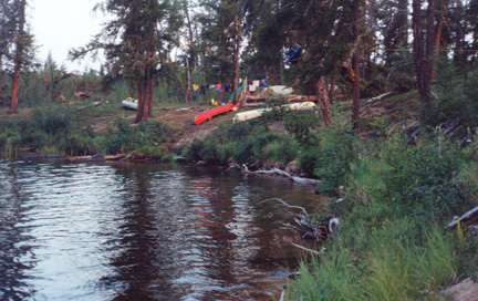
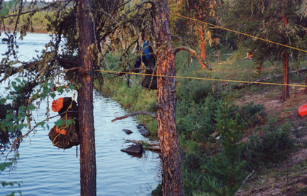
We set up camp at 8 pm. The site was nice except for the bugs. We went bathing (Alan in his bug hat), and cooked hamburgers. I was pleasantly surprised to discover that we had a couple of quarts of beer to drink. It had not occurred to me that this would be on offer. This however was for the first night only as beer is heavy to portage.
We went to bed at 11.30 pm after having hauled the food bags up into a tree and away from the bears.
I was in reasonable aerobic shape, but this was mostly from leg exercise. The first day had turned out to involve lots of upper body and arms, where I was much weaker. I wondered how I would feel in the morning!
On Day 1 we had paddled 30 km.