Introduction
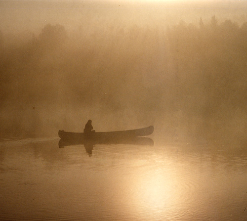
Canoeing in Saskatchewan can be magical in the early morning in the mist with the call of a loon.
Background for non-Canadians
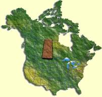 This trip was in Northern
Saskatchewan. It is about 1000 km or 650 miles north of Minot, the
northernmost city of North
Dakota. If you look on the map of Canada, Saskatchewan is almost in the middle
of the country. The trip area is
located at the southern edge of the northernmost third of the province, but all of the cities and towns are in the southern
half of the province, so the northern half is definitely wilderness. It
lies at about 55° 40' north latitude,
which means that in June it is still light at 10 pm and the sun is already high
by 4 am.
This trip was in Northern
Saskatchewan. It is about 1000 km or 650 miles north of Minot, the
northernmost city of North
Dakota. If you look on the map of Canada, Saskatchewan is almost in the middle
of the country. The trip area is
located at the southern edge of the northernmost third of the province, but all of the cities and towns are in the southern
half of the province, so the northern half is definitely wilderness. It
lies at about 55° 40' north latitude,
which means that in June it is still light at 10 pm and the sun is already high
by 4 am.
Although called the Six Portage Trip, the Saskatchewan Canoe Guide lists 13 or 14 portages for the whole trip. True, it is only six portages from the start until you get to the Churchill River system, but then comes the downstream trip on the Churchill River which involves an additional seven or so portages. The Churchill is an unusual river because of the geology of the rocks. The southern half of Saskatchewan consists of cretaceous rocks overlain by many metres of sedimentary deposits, forming that deep prairie topsoil. To the north of a WNW - ESE line through La Ronge, the underlying precambrian rocks come to the surface. These are extremely old (about 2 billion years!) volcanic and metamorphic rocks forming the area called the Canadian Shield. These rocks are also some of the hardest, so the rivers have not carved out canyons and valleys. Instead, the worn down stumps of mountains, more recently scraped smooth of soil by glaciers, consists of basins and the intervening rims, generally trending lower towards the east. The basins fill with water to form lakes, which spill over the lowest part of the rim, either in the form of rapids or waterfalls, into to the next basin. A more poetic image of the Churchill is a string of pearls. Traveling down the Churchill therefore consists of paddling across lakes, and then running rapids or portaging impassable sections as the river spills over into the next basin. During the last ice age, the ice was about a mile thick, and since it melted about 10,000 years ago, the hills around the lakes have become overlain with a thin layer of vegetative soil. The hills are heavily wooded with black spruce, with moss underfoot and muskeg (squishy swamp) filling the local depressions. On portages therefore you usually end up with wet feet and smelly socks.
The
Guide says:
This relatively short trip gives the modern voyageur big lake
experience, exposure to the Churchill River system and familiarity with narrow,
marshy waterways and small lakes. It
is not recommended for beginners, but is very popular and well used by canoeists
of intermediate skills. It is not
an especially difficult trip, and all dangerous rapids can be readily portaged.
Because parts of this trip involve possible exposure to strong winds and waves
on large lakes, ample extra time should be allowed to wait out bad weather which
may make big lakes unsafe to travel.
The length
of the trip is 105 km, and the time required is 5 to 6 days.
The Paddlers and the Canoes
The six paddlers were (in alphabetical order!):
Mike Baribeau, Brent Clark, Darryl Ferster, Jason Hill, Peter Long and Warren Long
For a picture and a brief note by Warren on each of us, you can click on the names. Every one except Peter writes software in Saskatoon. Peter is Warren's father and is a retired highway engineer, who lives in Northern Virginia. The ages of the team at the time of the trip ranged from 25 (Jason) to 69 (Peter). The rest were somewhere in between.
The
three canoes were all Mad River brand. Peter and Warren were in Peter’s red Kevlar,
Brent and Jason in Brent’s red Royalex (purchased from Keith Russell a few
weeks prior to the trip), and Mike and Darryl in Warren’s cream Royalex.